Trail creation across tidal Clearwater Creek
TRAILS: 4 hours: 3:30 PM to 7:30 PM
Opened up a route across the creek at tidewater, plus associated side trails in RMZ unit #3.
Clearwater Creek trail establishment/clearing. Made the connection across Clearwater Creek from the north side to the south side near the lowest (western) point at the high tide mark. Cut down an already-leaning small hemlock to bridge the stream, now running fairly strongly after the recent rains. Cleared a path along the mossy south bank of the stream, down to the big spruce that marks the tip of the tidewater slough. Great salmon-viewing trail, but no salmon in the stream yet. Lots of nasty blowdowns at this spot that obstructed the view out into the grassy slough – cut and piled a lot of that branchy material. Cleared an elk trail that wound its way up the south bank to the top of the high bank on the south side. Started establishing the E/W trail along the high south bank: first to the west a very short distance to the western boundary line (across a spring/wet spot), then to the east, uphill through a wide bench a little distance from the stream – not too far before I lost the light. Next step: hook up the South Bank trail to the established road system higher up on the south side.
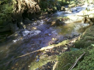
 Mouth of Clearwater Creek where high tide meets it.
This shows the creek at low tide, when it is all freshwater. At high tide, this becomes a tidal pool about one to two feet deep. The low, mossy bank makes it an ideal spot for viewing wildlife, especially salmon (seasonally) and river otters.
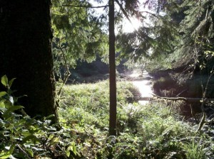
 Clearwater Creek estuary at the edge of the forest.
Looking west to the sunset over Chetlo Harbor in Willapa Bay from the edge of the forest, this is the small tidal portion of Clearwater Creek. The bay is about two hundred yards from here. The big Sitka spruce tree on the left marks the transition from forest to estuary, and is clearly visible on Google Maps.
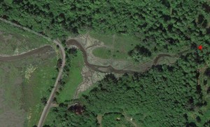
 Clearwater Creek estuary at low tide.
Google Maps view of the tidal portion of Clearwater Creek, where it enters Chetlo Harbor in Willapa Bay. The red star on the right side of the photo shows the photo point of the images above. The big Sitka Spruce is immediately to the left (west) of the red star, casting a large shadow to the north. (Click on the image to view a larger version). Government Road (aka Government Quarry Road) runs along the edge of the bay on the left side of the image.


 Spirulina