Archive for December 26, 2013
Trail creation from South Seep to High Road
TRAILS: 1.5 hours: 4:00 PM to 5:30 PM
Roughed out a trail route to connect the South Seep to the trail from High Road in Eastern Wedge unit #5.
New trail creation – continued main trail through Eastern Wedge unit #5. Cut through the collapsed hemlock thicket on the south side of the South Seep, roughing out the final connection to the previously cleared trail coming from the south. Trying to keep the trail on the high side to avoid the dips into the stream ravines. Lots of low branch pruning on trees along the trail route.
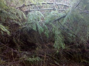 Collapsed hemlock thicket along the trail route south of South Seep.
Evidence of an ice storm or snow loading event is everywhere in this unit: entire collapsed stands, individual leaners, broken tree tops and hanging branches. Will have to cut through the middle of this to create the trail. Plenty of cleanup in the rest of the unit once the trail is established.
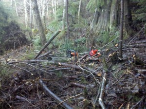 Slashed trees and brush at the edge of the collapsed hemlock thicket.
End result of cutting through the downed trees: “carpet-bombing” the forest floor. The trail will run along the right side of the photo, at the foot of the old cedar stump. Looking back north through the area just completed, the individuated trees are clearly visible. It is much easier to walk around in this unit now.
Continue Reading | Comments Off on Trail creation from South Seep to High Road
Trail revision through the Alder Seep
TRAILS: 2.75 hours: 1:15 PM to 4:00PM
Opened up a higher, more level route into the Alder Seep in Eastern Wedge unit #5.
Trail revision in Eastern Wedge unit #5. Cut a new route on the north side of Alder Seep to maintain the level grade as much as possible and avoid the original dip in the trail. Cut through the Doug firs on the hillside and emerged higher in the seep, with a gentle climb through the seep to the section on the south side. Test-carved the soft soil with the hand saw to create a level grade for walking – will return with a shovel and axe to finish the job. Only had to cut down one Doug fir (they are closely spaced here – this is one small part of the plantation that survived at close to its original stocking level).
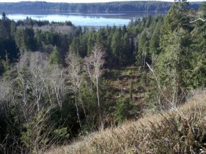 View to the SW over the mouth of Clearwater Creek Creek into Chetlo Harbor.
The body of water in the background is the tidal Naselle River (coming in from the east – on the left), emptying into Chetlo Harbor, a SE arm of Willapa Bay. Only a few residents and one oyster processing facility around this cove. Willapa Bay is the most pristine estuary on the west coast of the U.S.
Continue Reading | Comments Off on Trail revision through the Alder Seep
Trail revision across Clearwater Creek
TRAILS: 1.25 hours: 12:00 PM to 1:15 PM
Opened up a new upper creek crossing between the North Side and South Side trails in RMZ unit #3.
Trail revision across the creek. Opened up a new route across the creek at the upper end where the north and south side trails meet. The previous route was across “stepping stones”, but only works during low flows. About 25 feet upstream is a collection of old, large, mossy logs that bridge the creek, so I cleared paths to and across them. Extended the trail on the north side past the seep up to the log jam through dry terrain. Still need to carve the trail for better footing and deal with the wet section at the seep.
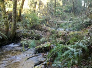 Newly opened creek crossing over big, mossy logjam.
About 25 feet up from the stepping stone crossing, this logjam will work for high water events. It has obviously been in place for a long time, with the creek managing to flow under and around it during many years of heavy rains.
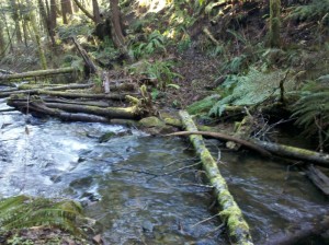 Original creek crossing over stepping stones.
Even with an extended winter drought, the stepping stones are partially underwater and this crossing can only be used during extremely low-water conditions (unless you have rubber boots!).
Continue Reading | Comments Off on Trail revision across Clearwater Creek



 Spirulina